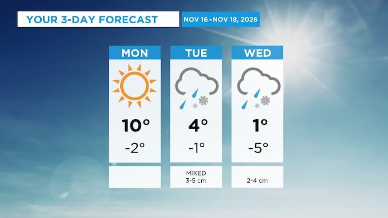
After a very warm start to November a major change is on the way. Daytime highs will drop from 10 C Monday to 1 C Wednesday, and over the weekend it is unlikely the temperatures will rise above freezing. The unsettled weather will enter Alberta from the southern border, bringing rain that will transition to snow. The counterclockwise rotation around this low is expected to create an upsloping effect with the mountains serving as a physical barrier and preventing the system from tracking back into B.C. These types of synoptic setups tend to produce highly variable precipitation totals which are difficult to predict until they enter the eastern side of the range. At this point it looks like the areas most likely to see the highest accumulations will be east of the Highway 2 corridor and between the Trans-Canada Highway and Highway 3. Calgary is likely to record snow on both Tuesday and Wednesday, with 3 to 5 centimetres possible Tuesday and 2 to 4 centimetres possible on Wednesday. This will be the first snow for the month of November – which is unusual for Calgary. According to Environment and Climate Change Canada’s normals data (from 1991 to 2010). November is usually the third snowiest month of the year averaging 18.8 centimetres of snow for the month, behind March (22.9 cm) and April (22.9 cm). The rest of the week should be dry in Calgary, but it will be cooler with daily highs ranging from 1 C to -3 C from Thursday through Wednesday, and daily lows between -4 C to -9 C. The normal high in Calgary this time of year is 2 C with a low of -9 C.