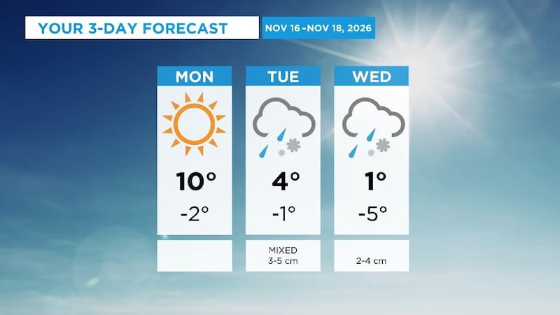
Get set for a big cool down by the end of this week as daytime highs slip to around the freezing mark by mid-week and then a few degrees below 0 C to close the week. Morning lows for the past number of days have been in the 0C to -4 C range. That’s the territory we’ll be in for daytime highs by Friday-Sunday. The persistent upper ridge (warm air aloft) is moving out and a cooler airmass will settle in for the back half of November. At this point, it doesn’t look like we’ll see a major cold snap, but temperatures will be around average or slightly cooler than the seasonal averages. Late November has average highs in the -1 C to -3 C range and morning lows around -10 C. But...we’re still in the milder air Monday/Tuesday. Temperatures should hit the 7 C to 9 C range Monday afternoon (after topping out at 9.4 C on Sunday in the city). We’ll be in the 3 C to 5 C range for a high Tuesday. Wednesday/Thursday will be a degree or two above the freezing mark for highs, which means MOST of the day will be below 0 C. For the Edmonton region and northern Alberta, there doesn’t appear to be much of a snow risk this week. There’s a slight chance of some flurries on Saturday, but the confidence in that is fairly low. Southern Alberta will probably get a decent snowstorm late Tuesday and through Wednesday. Early indications are that some areas from Calgary south could get 10-15 cm of snow and blowing snow will likely be a probably in southeastern Alberta Wednesday. Here’s the forecast for Edmonton and area: Today - Partly cloudy in the morning. Sunny in the afternoon. High: 8 Tonight - A few clouds. 9pm: 3 Tuesday - Sunny with a few clouds. Morning Low: -4 Afternoon High: 4 Wednesday - Mix of sun & cloud. Morning Low: -5 Afternoon High: 1 Thursday - Partly cloudy. Morning Low: -6 Afternoon High: 1 Friday - Mostly cloudy. Morning Low: -6 Afternoon High: -1 Saturday - Mostly cloudy. 30% chance of flurries. Morning Low: -7 Afternoon High: -3