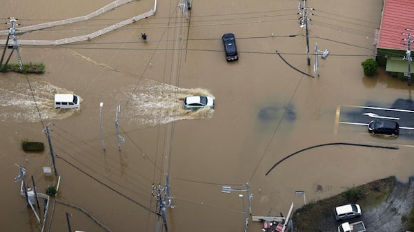
Severe thunderstorm watches are in effect for western New Brunswick, while eastern parts of the province remain under rainfall warnings Wednesday. There are also rainfall warnings and special weather statements in effect across Nova Scotia Wednesday. There are no warnings or statements issued for Prince Edward Island. New Brunswick Environment Canada has issued yellow severe thunderstorm watches for western New Brunswick, extending from Woodstock all the way up to Pointe-Verte. The agency says severe thunderstorms, which could last into Wednesday evening, could produce a tornado. “Conditions are favourable for the development of severe thunderstorms that may be capable of producing strong wind gusts, large hail and heavy rain,” said the agency. “Local utility outages are possible.” Yellow rainfall warnings are in effect along New Brunswick’s Fundy Coast, where heavy rain is expected to taper to steady drizzle or showers Wednesday afternoon. “Rainfall rates of 20 to 40 mm per hour may occur over some locations,” said Environment Canada. “Thundershowers are expected to develop over some areas, producing locally heavier rainfall, leading to highly variable rainfall totals over short distances.” Some areas could see up to 60 mm of rain. Nova Scotia Yellow rainfall warnings remain in effect for southwestern Nova Scotia, starting in the Digby area and extending along the Atlantic Coast up to the Moser River region. Environment Canada says heavy rain is expected to taper to steady drizzle or showers Wednesday afternoon, but another round of heavy rain is possible Thursday morning. “Rainfall rates of 20 to 40 mm per hour may occur over some locations,” said the agency. “Thundershowers are expected to develop over some areas, producing locally heavier rainfall, leading to highly variable rainfall totals over short distances.” Some areas could see up to 60 mm of rain. The rest of mainland Nova Scotia and Cape Breton is under a special weather statement, advising of a prolonged period of rainfall that may linger late into the day Thursday. The rain is expected to taper to steady drizzle or showers by Wednesday evening, but heavy rain is possible again Thursday morning. Between 30 and 50 mm of rain is expected in mainland Nova Scotia and Cape Breton. While the wet weather may dampen some people’s summer vacation plans, Jim Rudderham said wildfire crews in Nova Scotia are welcoming the rainfall. “We’re hoping to get upwards of an inch of rain over the next couple of days, which will be very, very helpful to the whole province,” said Rudderham, the director of fleet and wildfire management with Nova Scotia’s Department of Natural Resources. “We do need the rain. Water levels, as everyone can see, the brooks and lakes are going down, the ground is dry, the fuels are dry. We did get some good rain last Saturday night, which was wonderful. We will always take rain, but it is still dry.” Rudderham noted the province saw little rain last summer, which led to extreme drought and wildfires into the fall. “We certainly don’t want to see that again,” he said. “Ideally, if we can get an inch of rain a week, or 25 mm of rain a week spread over that week, every week, we would be very happy in our world.” A senior communications advisor with Halifax Water said the utility is also grateful for the rain, as the past few weeks have been quite dry. However, Brittany Smith notes the water levels are in good shape this year, compared to last. “This isn’t including the rain that’s coming over the next couple of days, so we’re in a good position and a lot better compared to last year at both of our main lakes,” said Smith. “At this point, if we get the amount that is anticipated, this would move us past several weeks ahead of where we would be at last year.” Les Suêtes Wind warnings Yellow Les Suêtes Wind warnings remain in effect for Inverness County – Mabou and north. Environment Canada says Margaree Harbour to Bay St. Lawrence could see “damaging” wind gusts of up to 90 km/h. “Driving conditions will likely be difficult. High-sided vehicles will be pushed around by the wind,” said the agency. Nova Scotia could see flooding Nova Scotia’s Emergency Management Department says the rain could lead to flooding and is urging residents to prepare for possible road disruptions. “Heavy rainfall can quickly overwhelm drainage systems, cause rivers and streams to rise, and create dangerous conditions on roads,” said Emergency Management Minister Kim Masland in a statement. “Residents should stay informed by monitoring weather forecasts and alerts. They should avoid unnecessary travel during periods of intense rainfall and never attempt to drive through flooded roadways.” Masland said Nova Scotians living in flood-prone areas should take additional precautions to protect their homes and properties. She also said emergency management officials, municipalities and first responders are monitoring the situation and are ready to respond if needed.