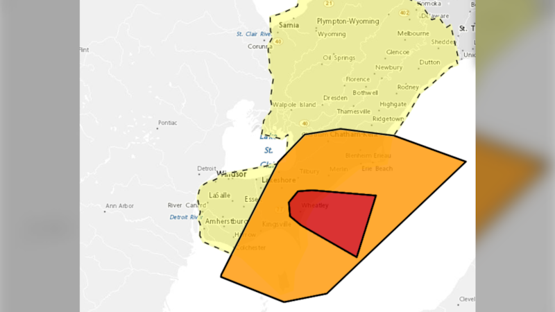
Another round of severe weather is moving through southern Ontario, with several severe thunderstorm watches. Radar indicated a tornado in Wheatley Provincial Park. A large storm system moving through Michigan has prompted tornado warnings in the U.S., while storms are moving through Lambton County, western Middlesex and western Elgin, where weather watches and warnings are in effect. The main threats include torrential downpours, damaging wind gusts and hail. PHOTO GALLERY: Sept. 2, 2026 storm damage CTV London meteorologist Julie Atchison says the storms are developing along a stalled frontal boundary across southern Ontario. “Unfortunately, rain back in the forecast Friday morning,” Atchison said. Scattered showers and thunderstorms are expected to move into the London area over the next couple of hours before the risk of storms comes to an end overnight. The skies will remain mainly cloudy, with another chance of showers Friday. Rainfall totals Friday are expected to be under 2 mm, although 10 to 20 mm could fall in areas hit by heavier thunderstorms. Some sunshine is expected Saturday, although there will still be a 40 per cent chance of showers. Daytime highs over the holiday weekend are expected to be around 25 C. Sunday is expected to be mostly good, with Monday shaping up to be a beautiful day for the Labour Day holiday.